MacRitchie to Bukit Timah: Best Outdoor Training Walk
The MacRitchie to Bukit Timah route is widely walked by those looking to train their fitness for future expeditions.
Singapore may not be the best place to train with the lack of hilly terrain, but there are ways to maximise what’s here and improve your fitness. There are plenty of 40-storey blocks for stair-climbing to build your cardio and stamina. The nature reserves are there to simulate long-distance walking in the wilderness. They helped in my training for treks like Yubeng Village in China, and Semeru in Indonesia.
This post will show you what to expect from MacRitchie Reservoir to the ‘highest peak’ in Singapore, the Bukit Timah Nature Reserve.
Intro to MacRitchie Reservoir
The MacRitchie Reservoir is popular for those looking to get their dose of nature. First opened in 1867, MacRitchie Reservoir is one of the four reservoirs within the Central Catchment Nature Reserve. Together, the reservoirs support the country’s water resources.
Have a look at the map and you’ll notice the green lungs of Singapore. I like to think the Central Catchment Nature Reserve is the Amazon Rainforest of Singapore. At least we have a real forest in the urban jungle of an island.
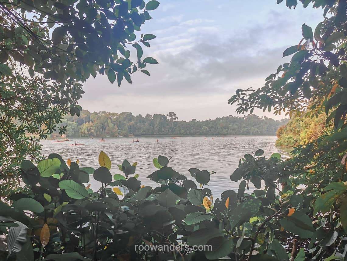
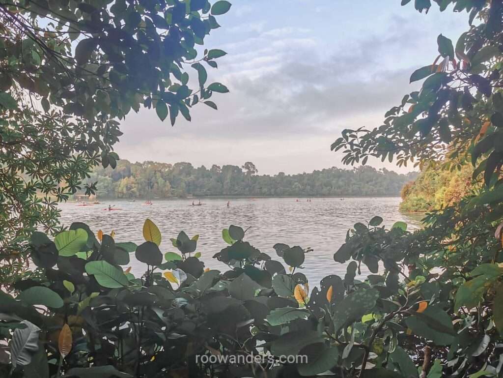
MacRitchie is also popular for those looking to stroll in the wilderness, forest bath, or water sports. The 11 km trail that encircles the reservoir sees runners and walkers sharing the decently manicured trail.
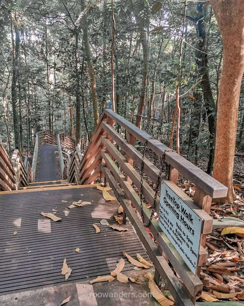
One major highlight you should not miss if it’s your first time at MacRitchie is the Tree Top Walk. I’ve walked countless times, but for newcomers, the one-way route on the large suspension bridge over a forest is a walk to remember. And it is free.
Intro to Bukit Timah
Bukit Timah Nature Reserve is next to the Central Catchment Nature Reserve, and home to Singapore’s indigenous flora and fauna.
The Nature Reserve was established in 1883 – 64 years after Stamford Raffles came to Singapore – by the Superintendent of the Singapore Botanic Gardens. Several policies came in over the decades to protect and maintain the ecology of the forest.
That aside, most people are at BTNR to climb Singapore’s tallest peak at 163 m. Which is about the height of The Pinnacle@Duxton Block 1C to put things in perspective.
Unlike the Gunungs of Malaysia, we have a nicely paved, albeit steep, road up to the peak. Alternatively, you can climb up the stairs at the halfway point, which can be a taxing exercise that takes just under 3 mins.
Interested in doing a round island walk around Singapore? I’ve done mine and written about it here.
The Walk
Spare at least the whole morning to start the walk. I usually start before 8 am from Caldecott MRT and end before 11.30 am for lunch at Beauty World. That is including time to slow down at bottleneck areas, check out the animals, or for hydration. The walk covers at least 10 km.
Caldecott MRT
Caldecott on the Circle Line and Thomson East Line is the nearest MRT station to the entrance of MacRitchie Reservoir. You’re here to do some walking right? That means an extra 10 – 15 mins walk from the MRT station to the reservoir is no biggie. ;P
If you were to exit from EXIT 1, it’ll be a nice walk by a group of flora markets beside Thomson Road, before a traffic crossing over Lornie Road.
If you were to exit from EXIT 2, you would cross a traffic crossing over Marymount Road, and then an overhead bridge to MacRitchie.
Exiting from EXIT 3 or 4 requires crossing a couple more roads, but all roads – or exits in this case – lead to MacRitchie.
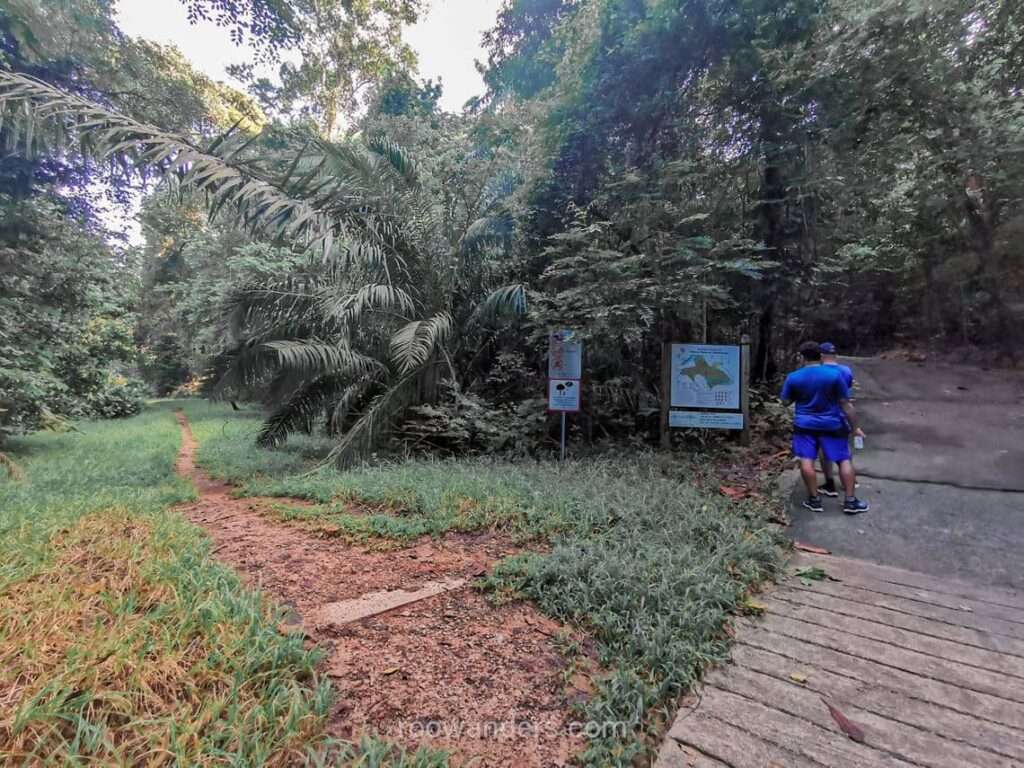
MacRitchie Trail
Follow the track as shown on my Google Maps. If you would like to buy some more hydration or do the last toilet break, do it at the Amenities Centre. Else, amble by the perimeter of the reservoir – passing a group of paddlers carrying their kayaks along the way – to reach the start of the trail.
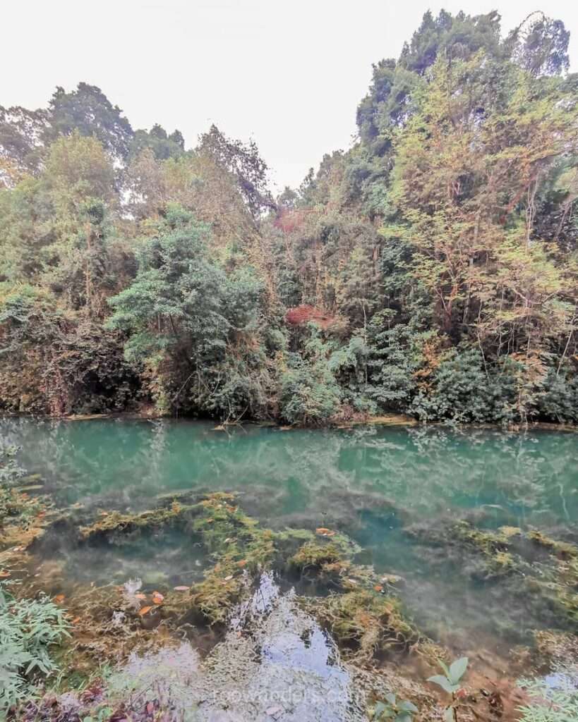
There are two paths from here, but both would converge eventually. The Prunus Trail – which later becomes the Petai Trail – has a longer distance than the main trail. Both trails are boardwalks at the edge of the reservoir with super views.
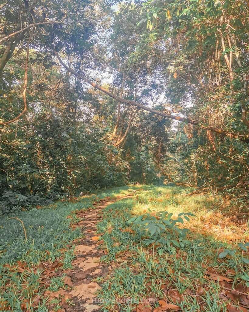
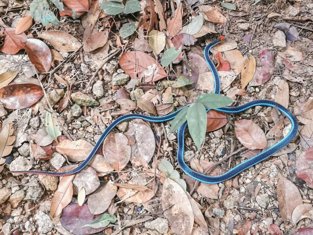
The main trail is a gravel road shrouded by towering trees. You may get occasional sightings of snakes, despite the track’s popularity. Trail runners and walkers mostly use this trail.
Junction
There are a bit more steps to do here at the junction, where trails from Windsor Nature Park connect.
Ascend the steps and you’ll reach a piece of road by a fenced building. You could choose to walk the road and enter back into the forest via the second entry point towards Ranger Station, but that’s boring. I’d usually pop back into the forest asap unless there is slow-moving congestion on the main trail.
Ranger Station
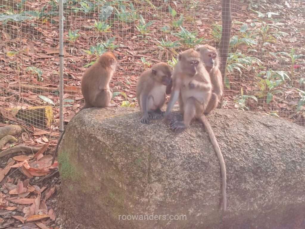
Stop by here for some much-needed hydration – there are water coolers – or a toilet break. Beware of the pesky monkeys. They can invade your space and steal your bottle or food if they’re kept in plastic bags. Try to keep plastic bags out of sight.
Treetop Walk
If you’re new to this trail, head right and continue towards the Treetop Walk – a must-do for any newcomers. You’ll eventually reach a steep road. Ascend the road to a one-way boardwalk towards the suspension bridge. After the bridge comes more boardwalks and steps that exit at Macaranga Hut.
Rifle Range Road
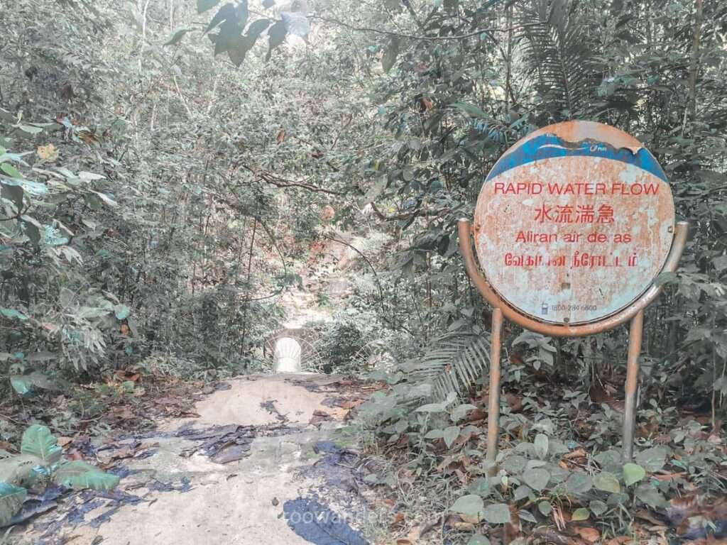
If you’ve done Treetop Walk a million times and have had enough of waiting for others to finish their selfies (this is a narrow one-way route!), diverge to the left for a small path just before the steep road. The barren path is small and stomped into existence by runners and hikers. It cuts through everything mentioned under the Treetop Walk Trail to reach Macaranga Hut.
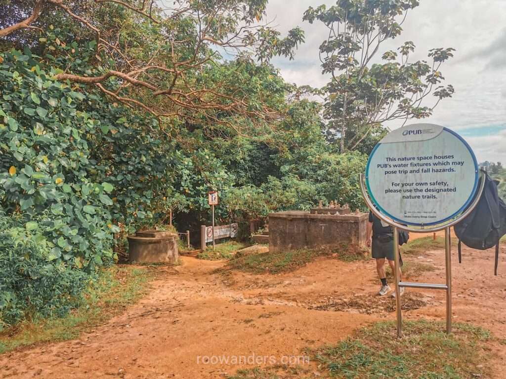
Continue to blaze through and pass by a peculiar sight of twin pipes at the PUB Rapid Water Flow.
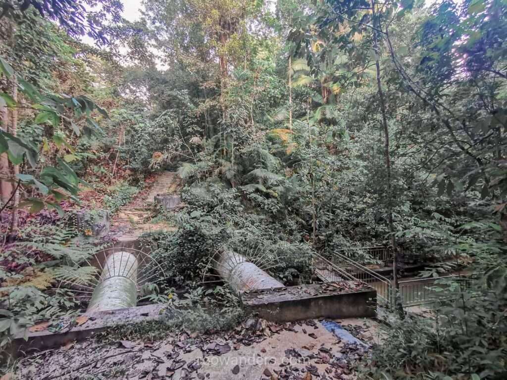
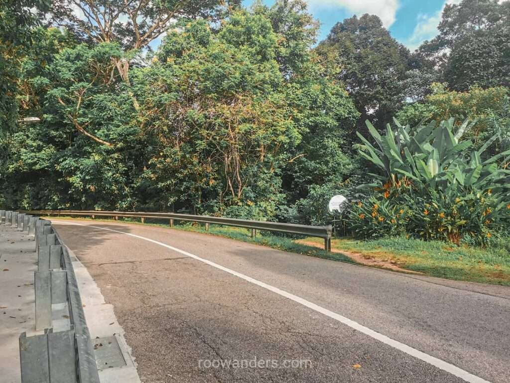
Cross the small bridge and tunnel away until you’re out of the forest and onto the real Rifle Range Road with a carpark and a fenced building by the left. This is a pretty boring and scorching road with the occasional fast and furious road bikers.
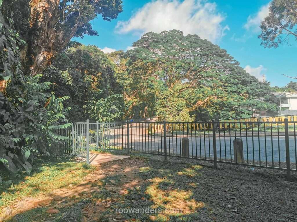
By the time you’ve reached the Rifle Range Flyover that looks over the Bukit Timah Expressway, you have abandoned the Central Catchment Area behind and are heading towards the Bukit Timah Nature Reserve.
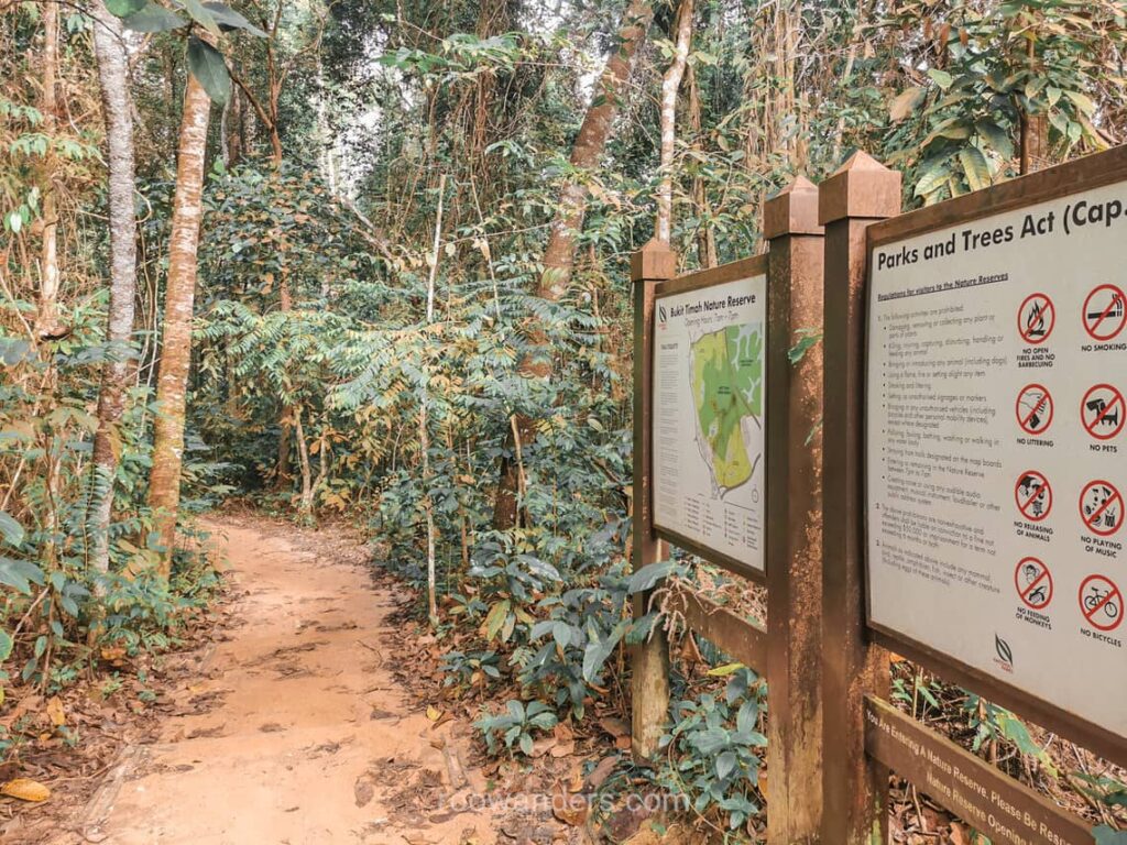
Entry into Bukit Timah Nature Reserve
Entry into the Reserve is a bit tricky. Pay attention to the right side of the road for an opening into the forest. On Google Maps, it’s recorded as the School of Ammunition. Watch the road for flying cyclists or cars before crossing!
If you’ve missed this opening, you won’t be getting into the trails of BTNR. However, there’s another small trail into Rifle Range National Park down the left side of Rifle Range Road, which isn’t that bad either.
As you wander back onto grassy terrain, take note of incoming mountain bikers. This part of the reserve has designated paths for mountain bikers, and the portion we venture towards the true entry is shared with them.
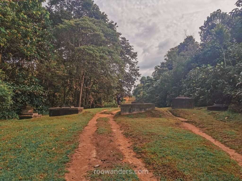
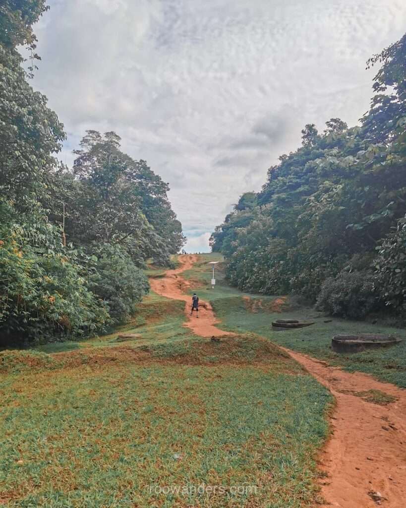
Climb a small slope towards a group of concrete fixtures. You’ll notice an opening along the way, but that’s for bikers, not hikers.
March forward and ascend another hilly slope to another set of concrete fixtures. Our true entry point lies on the left with clear signs pointing to its whereabouts BTNR.
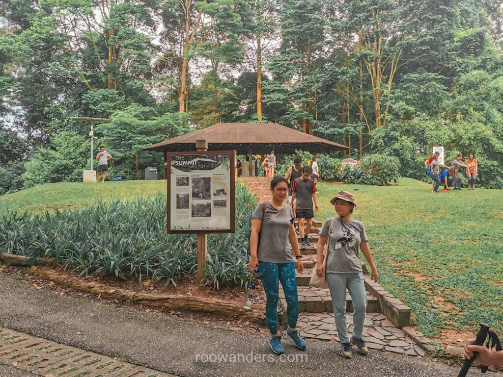
Bukit Timah Summit
Congratulations on successfully reaching the reserve. Roads within the reserve are straightforward with clear signs indicating their destinations. You could go on and visit the northern corner of Dairy Farm and the quarries.
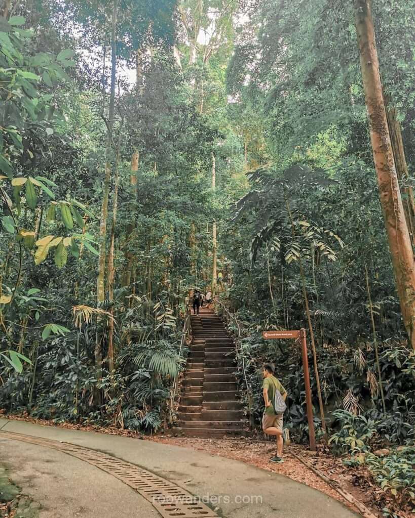
Else, we follow the initial objective, which is a loop around the summit and back down to BTNR Visitor Centre for a wash-up before leaving. You could walk up the slope or pick the steps halfway through. Take note of the super steep descent as you inch towards the visitor centre. That can act on the knees.
Beauty World MRT
Leave the reserve via the small roads towards Upper Bukit Road. Rather than walk by the main road, climb the rugged steps onto the Old Railway Bridge and into the Rail Corridor Track. Both paths eventually lead to an overhead bridge to Beauty World Centre. Grab your lunch or coffee before bidding a great workout adieu at the Beauty World Downtown Line.
Attire
Your normal sportswear would do fine for most of the trails. But having a pair of shoes designed for rugged trails is even better as you fear less of slipping on some paths I’ve mentioned above where the grounds can get wet and muddy.
A pair of mid-cut hiking shoes is overkill, but I sometimes wear them out as well. Better to exercise in them frequently lest they break apart on major hikes.
Ending
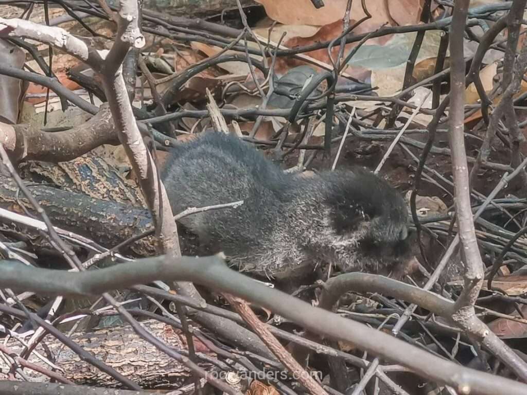
I love walking this trail for the forest cover and random sightings of wildlife. Thus far, no walks have left me disappointed. I’ve caught sight of numerous snakes, heard the calls of birds I don’t usually hear outside the forest, and seen and heard the cries of a civet kitten once! Walks like this in Singapore have more animals than the walks I did in New Zealand.

What I don’t like are the crowds. You cannot really tell if the trails will be packed or not. I’ve met times when the crowd was sparse on a cool weekend morning, and times when it was packed with people, on a sweltering weekend morning. I’ve also heard of others complaining about how the trails can be full on a Monday morning – full of retirees!
Monkeys can be annoying, and they are found in abundance at Ranger Station and the real Rifle Range Road. Keep a distance and keep your bottles and plastic out of sight and you should be fine.
If you enjoy hiking as much as I do, be sure to check this post on hiking in the wildest spot in Singapore – a true gem at Clementi Forest.


You May Also Like

The Singapore Army Openhouse 55th Anniversary | AOH22

The Rail Corridor South Guide
