
Bukit Timah Nature Reserve: A Hiker’s Training Ground
Bukit Timah Nature Reserve is a place I frequent in Singapore.
This rainforest-rich park, which houses ‘the natural peak of Singapore’, is where I do my weekly fitness walk and touch grass.
I like to call it forest bathing, but the park, shortened as BTNR, is never that quiet to meditate and observe the trees, as the Japanese who coined this term Shinrin-yoku describes.
With 5 million people living on this island country that could fit within Lake Tekapo of New Zealand, or less than 750 km², there’s always someone right behind you while walking in the park.
Anyhoo, BTNR remains the best playground for me to enjoy nature, sweat a few cups of water, and train for my overseas peaks while living in Singapore.

Brief Background of Bukit Timah Nature Reserve (BTNR)
BTNR is protected in Singapore as part of The Central Nature Park Network.
Look at the map of Singapore, and the middle green part of the island is the Central Nature Park Network.

I like to romanticise the green part as the heart and lungs of this diamond/ rhombus-shaped country, and the trees and park connectors as the arteries streaming out of this heart.
Singapore may be a concrete jungle, but it does have a green centre and spots to enjoy nature for its million inhabitants!
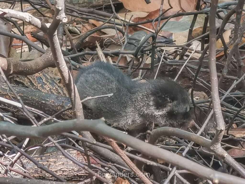
I could see more animals within an hour in BTNR than the 3D2N hikes in the Great Walks of New Zealand.
Some fun facts about BTNR gleaned from the infopedia of the library:
- Bukit Timah is Singapore’s highest natural peak. It is 164 m tall. The towers of Marina Bay Sands are above 200 m. Singapore’s tallest building is the Guoco Tower at 283 m.
- ‘Bukit Timah’ translates from ‘Tin Hill’ in Malay. But the hill contains mostly granite rather than tin. The name may have been loosely adapted from Bukit Temak, where Temak refers to a kind of rainforest tree, in Malay.
- The hill came under protection in 1884. If gone unchecked, BTNR would have been deforested with an overgrowth of pepper and gambier plantations and granite production. The government even had patrols in the late 1880s to stop illegal activities. A superintendent of the Botanic Gardens pushed for this protection.
- Reforestation effort was slow. Considering the size of this small state, no one could see the ecological benefits of the forest when the people were barely surviving. BTNR saw its forest reserve protection momentarily revoked in 1931 due to low-income generation, until a forward-looking director of the Botanic Gardens rallied for it 5 years later, like his predecessor did half a century ago.
- Forest Reserve. BTNR was re-recognised as a forest reserve in 1939 when it finally came under the charge of the Gardens.
- Granite quarry. Aside from logging deforestation for cash crops, one of the main threats to BTNR was granite quarrying, which fuelled Singapore’s development into the 20th century. Think early HDB and roads. Again, it was the ambitious director of the Botanic Gardens who advocated for the protection of the forest. Hindhede Quarry, nearest to the entrance of BTNR, was only closed from operation in 1990 and made accessible to the public more than a decade later in 2001.
- Tigers. There used to be tigers living in BTNR until the 1930s.
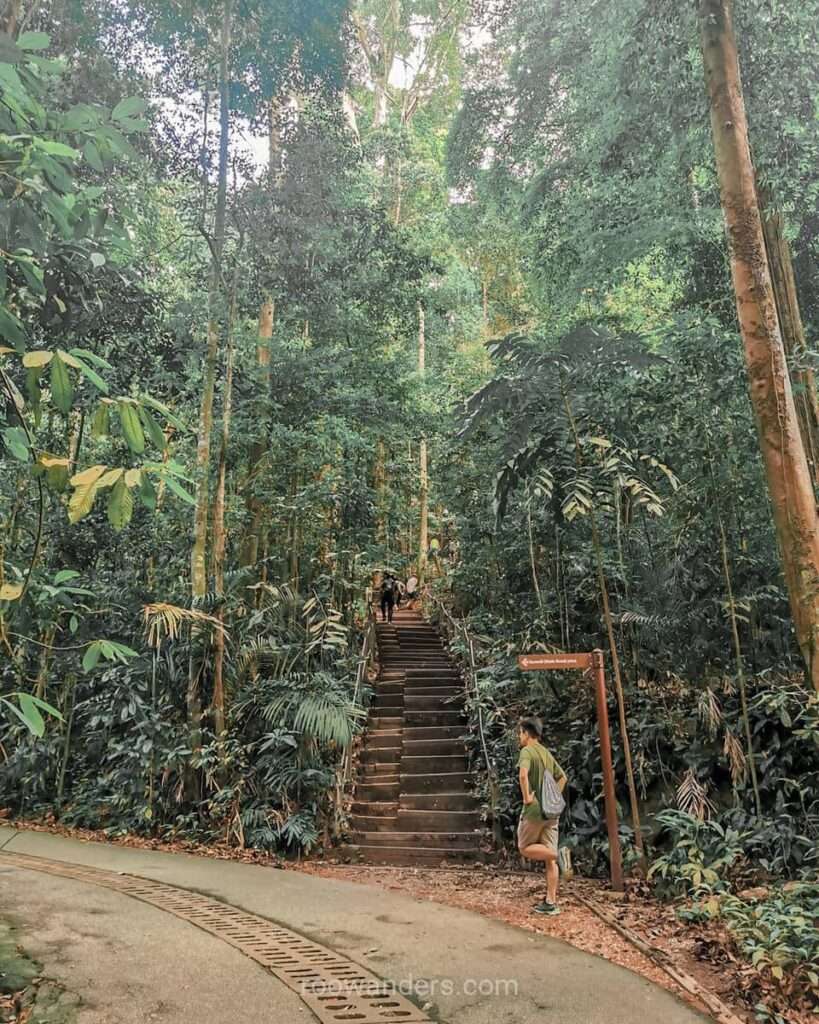
- Garden City Vision. There’s been an increased awareness of the ecological value of trees and greenery following Singapore’s independence. With that, more effort was poured into protecting the reserve, including demarcated tracks and boardwalks and steps to prevent soil erosion. Note: With that, understand the importance of walking within the path!
Aside from hiking in Bukit Timah Nature Reserve, I’ve also walked one loop around Singapore, which took me 5 days and 160 km.
How to Get There
The closest MRT station to Bukit Timah Nature Reserve is Beauty World station on the blue DownTown line.
Enter Beauty World Centre and take the escalator to the top floor where the food court is. From there, cross the overhead bridge to the other side of the road.
There are three choices here: (1) descend back to ground level and follow the pedestrian walkway to Hindhede Drive, (2) descend and walk the Rail Corridor to Hindhede Drive, or (3) walk towards the Rifle Range Park but turn right into Hindhede Link sheltered amongst the trees to the same Drive.
I usually pick (2) for, you know, more forest bathing and chances to spot animals, and exit via (1), which is the shortest road.

There are a few condos and landed properties within this narrow Hindhede Drive. At the end of Hindhede Drive is the walk entrance to Bukit Timah Nature Reserve. Turn left to enter a car park that’s almost always full. This car park is next to the Hindhede Quarry. There’s another car park at the top right corner of Bukit Timah Nature Reserve, next to the Wallace Trail.
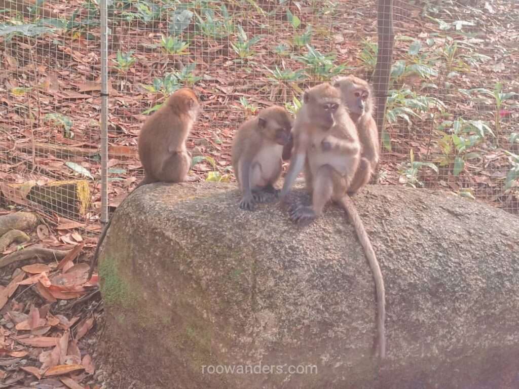
According to the card on the gates into the reserve, BTNR is open from 7 AM to 7 PM, but I suspect one could still go in at their own risk. There are no lights within the trails. Watch out for the monkeys!
Trails in BTNR
The Bukit Timah Nature Reserve suggests 5 possible trails with varying intensities.
Note: BTNR also has a mountain biking trail loop around its periphery. You won’t cross paths with the bikers if you walk within the demarcated trails within BTNR unless you’re heading to MacRitchie, where paths are shared, or near the Wallace Trail.

Route 1 (red)
Route 1, coloured red on their map, is rated as moderate.
It goes up the steep slope towards the summit via the concrete.
The first part of this concrete path is very steep and can be strenuous if you are not as fit. Then come the steps towards the summit, which take around 2 mins, depending on your fitness level.
Route 2 (blue)
Route 2, coloured blue on the map, follows the same steep concrete path but diverts left at Simpang Hut to the Telecom Tower.
If it were me, I’d rank this as easy rather than moderate, since there are no steps to the summit like Route 1.
There’s no good view of the Hindhede Quarry from the telecom tower, so there’s nothing much to gain here.

Route 3 (green)
Route 3, coloured green and rated as difficult on the map, turns from the main road, or the steep concrete path into the forest. It goes on gravel or soil rather than concrete paths or boardwalks, with an undulating terrain.
Route 3 also links to other paths like:
- The Taban Loop, which goes back into the Route 3
- The Kruing Path, which merges back to the main road sans the very steep section
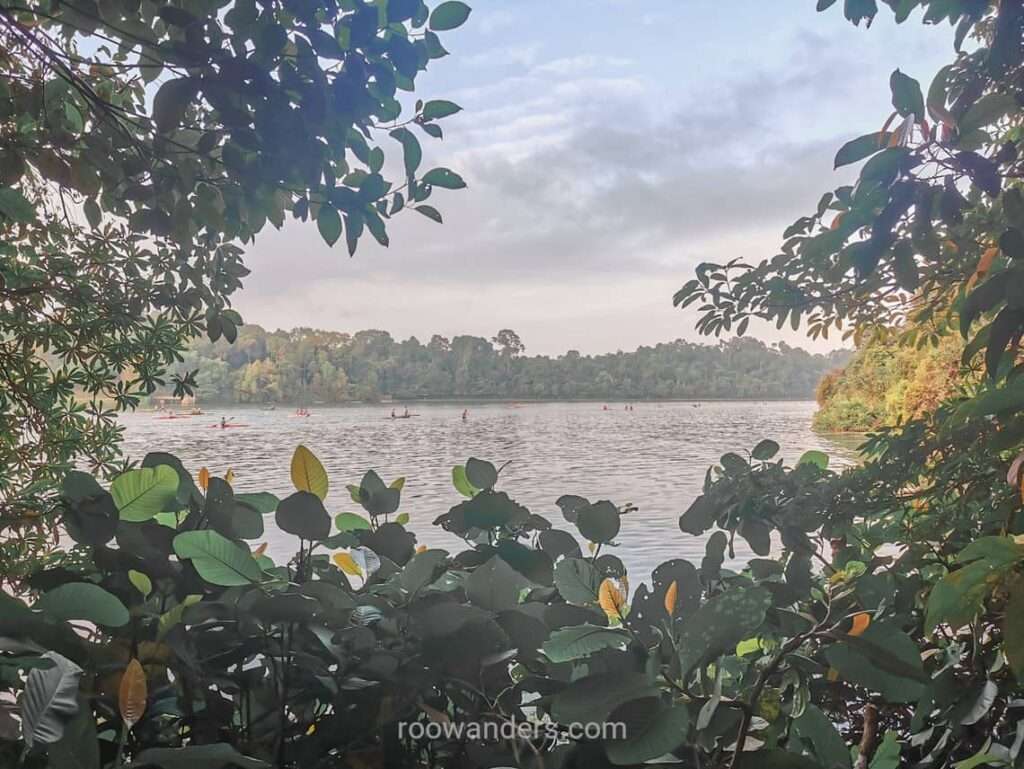
- The catchment path, which could be linked to MacRitchie Reservoir
- The summit steps
I don’t think this path should be marked as difficult as Route 4 below.


Route 4 (yellow)
Route 4, coloured yellow and rated as difficult, is broadly termed the Dairy Farm Loop for extending beyond the summit to the upper region of the reserve.
As with Route 1 and 2, it follows the steep concrete path to the summit. From the summit, the path exits via the nearest steps from the main road to Rengas Path and into the Dairy Farm Loop.


If you were to take the loop from the right via the lower loop, the descent is minimal, but the ascent via steps from the Dairy Farm Hut can be a kick and test on your fitness level!

Taking the loop from the left via the upper loop will get your knees hammered from all those descending via steep steps.


Route 4 is also linked to a Jungle Fall Path which can further your fitness training with its steep steps that range hover between an elevation of 130 m and 155 m.
Route 5 (pink)
Route 5, coloured pink and rated as difficult, resides within the Rifle Range Nature Park. It’s on gravel or soil with steps and links to Rifle Range Road, towards MacRitchie Reservoir.
I’ve taken Route 5 once and don’t find it particularly challenging compared to Route 4.
All routes with soil or gravel terrains are somehow rated as difficult by the park.
My Favourite Path
My favourite weekly route is a mix of the Dairy Farm loop (Route 4) and side routes not labelled by the map.
I cannot appreciate walking on concrete and dove straight into the South View Path, coloured green on the map immediately after the toilet. This track goes to the Catchment Hut and later merges with the main concrete road.

From there, I’d climb the steps to the summit, and descend a little via the main road, to enter the Rengas Path.
The Rengas Path merges with the Dairy Farm Loop. Thereafter, it’s descending the lower loop to the Dairy Farm Hut, followed by the pain of climbing the steep steps of the upper part of the loop.


As the Dairy Farm Loop links back to the main concrete road, I’d exit via the Jungle Fall Path to huff and puff up more steep steps, ascending to a height of about 50 m, and exit back to the main loop.
Towards the end of the main road where the steepest section is about to begin, I’d drop back into the South View Path via Kruing Path, and exit to the gate.
Mountaineer’s Training Path
From what I’ve learnt, mountaineers in Singapore also trained in BTNR, but are specific in the sections they do, focussing on three spots that have the steepest inclination.
Their fitness routine, which comes with a weighted bag, focuses on repetitions on (1) the summit steps with a 50 m elevation difference; (2) the Rengas Path which has a 30 m elevation difference; and (3) a section of the Jungle Fall Path, which has about a 50 m elevation difference.
Repeat 6 times for each station – ascend and descend via the same path – before moving on to the next one.
I could only manage 2 – 3 reps for each with very little weight before giving up. It’s too boring to sustain my motivation.
Disclaimer: the elevation differences are estimates based on the topography lines on the map, since I dislike wearing a smartwatch so I shall leave them as that.

Pointers to Note
- Fill your bottle with the cooler beside the toilet. This is the only water cooler within the reserve. There is another toilet/ water cooler at the Wallace Trail, a short distance after exiting from the Dairy Farm Hut.
- Be courteous. The path is narrow. Keep to your left for others to pass. Don’t be that group that chats and ambles on the path, blocking the way of others who are faster. Keep left!
- If walking with hiking poles. Be aware of your pole and don’t stab the people behind you when you lift your hands.
- This is not a competition. Take it slowly and enjoy nature as you walk. Take a breather at the huts or give way to others. This is not supposed to be a competition.
- Take note of slippery grounds. Especially after a rainy day. There are certain sections of the trails that cut across a stream and are always wet.
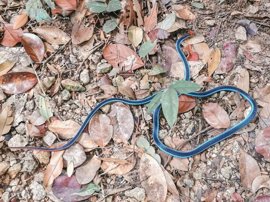
- Watch where you’re stepping. Sometimes there may be a millipede or bug minding its way across, or even a snake if you’re lucky.
- Keep your plastic bags and wrappers out of sight. Monkeys are attracted to them.
- Wear supportive footwear. With good soles to reduce slipping and spraining the ankles.
Conclusion/ Rambles
My weekly hikes in BTNR are like a check on my fitness level. Am I ready for that small hike overseas?
Weekly hikes also maintain the mobility of my ankles, flexibility of my legs, my sense of balance and stability, and cardiovascular health. Regular maintenance is better than a pent-up rush on training, which could lead to more injuries or incidents like this woman who fractured her ankle while climbing Kota Kinabalu.
When I know I have a strenuous hike, I double up on my efforts with the steps of a 40-storey block or BTNR. Maybe 4 to 6 repetitions or blocks per training?
But the stairs I took to train for Rinjani and Semeru, and later the monotonous Mountaineers’ Training for Kerinci, were all too boring to sustain for long…
Relying on BTNR alone isn’t enough for an overseas hike ranging from 8 to 10 hours, or 10 to 15 km, or a hike that spans for days and where you’d need to carry your food and other camping necessities.
That’s when you’d have to mix in some longer day hikes in Malaysia, like Berembun, Nuang or Ophir, perhaps carrying a weighted bag.
I prefer to do the long walk from MacRitchie to BTNR, which I call one of the best outdoor walks to train on endurance with a weighted bag, since the walk could take half a day and covers at least 10 km, plus there’s a chance encounter of snakes and other wild critters to keep me excited. 😝


You May Also Like

Singapore Round Island Walk | 160km 5 Days

A Full Day Budget Itinerary in Singapore
